
Went for a two three hiking tour beginning of May in and around Ramsau. Due to the weather one day was a real hike, one was a more a boat and walk day and on the rainy day it was visiting a documentation and a salt mine.
So here it is, the list of places visited
Ramsau
Ramsau is part of the high alpine region of Berchtesgaden. With a population of 1700 there is a protestant church Zum guten Hirten and a catholic church St. Sebastian and a pilgrimage church Maria Himmelfahrt. Haven’t been, but from the pictures in the internet, especially the catholic churches are worth a visit.
Stayed in a very nice Inn, a little outside of Ramsau, a little up hill….

…and a spectacular view from the porch.

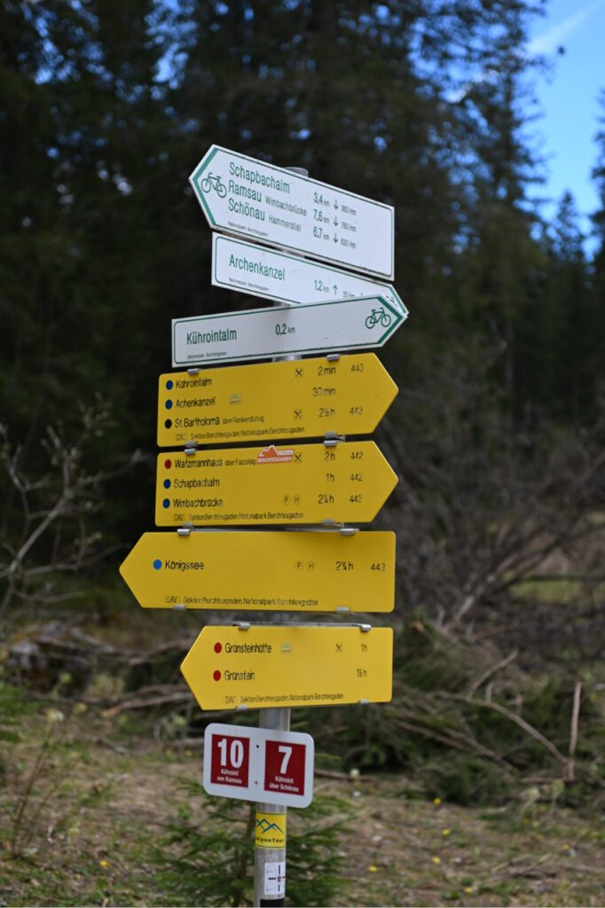
The hiking tour started at the parking Hammerstiel in Hinterschönau, 738m.
The hiking tour started quite steep over a small track until reaching the Kührointhütte with the highest elevation 1420m.


Half way up there is a “Rast Kastl” a little box that usually is filled with Beer. But that day it was not 🙁 .

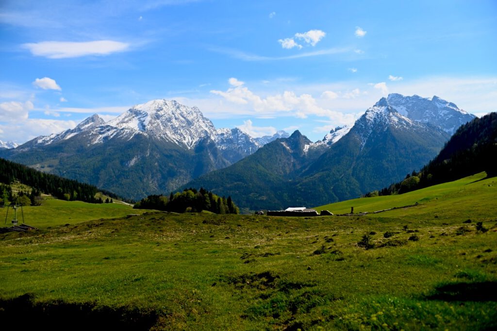
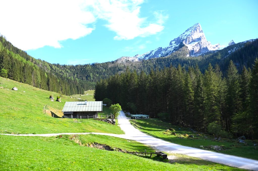
Impressions from and during the hike


As it was still rather chilly in the shade, it was a great relief that the Kührointhütte was open that day and that proper home made food was served and of course they had Beer 😉


From the Kührointhütte, it’s another 20 minutes almost flat walk to the Archenkanzel.

From the Archenkanzel there is a spectacular view on the Königssee.
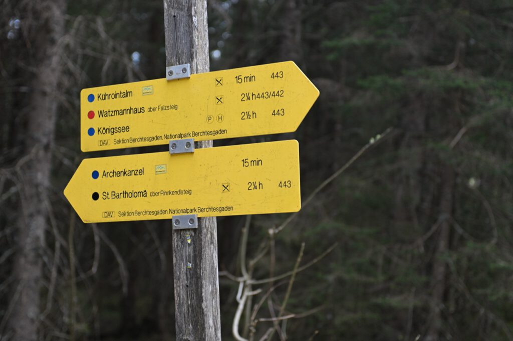


As the mountain falls steep, there are no roads going up. The only way is to walk from St. Bartholomä, which takes about two to two and a half hours…down!
The way back to the parking place was by the utility road.
The entire tour on a page. The right path was going up. The left path was going down.

The key facts about the hike are
– total length: 16,3km
– total elevation: 1530m
– total time: 8h20min
Most impressive view was from the Archenkanzel, 1346m, overseeing the Königssee.
Salt Mine and Documentation Centre
Salt Mine in Berchtesgaden

The salt mine in Berchtesgaden is the oldest still active salt mine in Germany.
It origins in 682 AD when Theodor II, Duke of Bavaria gave Bishop Rupertus from Salzburg 20 Pfannenstädel (presumably the right to produce salt). Today’s salt mine was founded in 1517. The “wet salt” production makes Berchtesgaden so special. Basic principle is that a hole is drilled and water is pumped into the hole. The water takes up the salt and the salty water is pumped to Bad Reichenhall and further processed.
The tour through the salt mine starts with getting an overall and a ride on the mining railway going 650 deep into the mountain. The tour continues by foot showing how the salt extraction and processing evolved over time, ranging from wrenches with hemp ropes to pneumatic drills.
For fun there are two wooden slides. One is 34m long from the railway end station to the Kaiser Franz Sinkwerk, where your picture is taken. And the second slide is pretty much at the end and slides you 40m to the Spiegelsee. A little ferry takes you over the 100m long and 40m wide salt lake, complimented by a nice light show – try to sit on the right side for better view.
Documentation Centre in Obersalzberg
Obersalzberg is inevitably connected with the Kehlsteinhaus, or Eagle Nest and with that with Adolf Hitler. The documentation centre impressively shows how the Obersalzberg was developed to be, besides Berlin, the second command centre.

The documentation also gives access to a small portion of the bunker, provides an impression of the life in Obersalzberg as well as connects local events with the global action from the military. Definitely a must see, where you should bring at least a half day time, to go through the entire documentation, but also to digest.
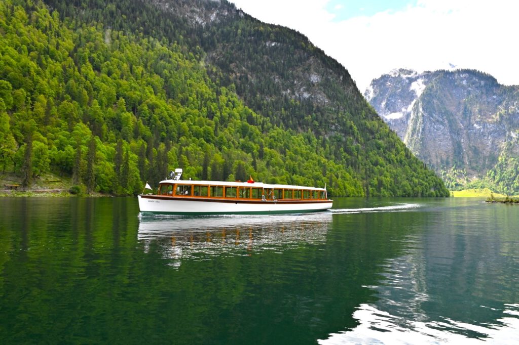
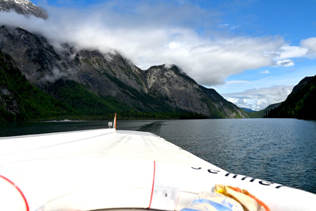
Königssee

The Königssee is a 5,2sqkm mountain lake filled with 512 million cubic meter water in drinking quality. Despite over half a million tourists a year this is possible, because there are no motor boats allowed on the lake – take away the police, Red Cross, ranger and innkeeper.
Since the 18th century tourist were taken by row boats over the Königssee. In 1909 the first electrical passenger ship was put into service. All boats were mad fully out of wood. In 1998 the first boats with a steel hull were built. The boats weigh forty tons of which four tons are battery which last throughout a day.
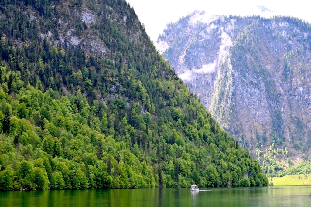

Roughly half way to where the Königssee ends lies the roman-catholic pilgrimage church of St. Bartholomä. Due to the steep mountains it can only be reached by boat or over challenging foot paths. The church was build in 17th century on foundation of former building from the 12th century. After secularisation in 1803 the buildings on the peninsula went over to the Kingdom of Bavaria in 1810.
Beside the beautiful church there is also a fish restaurant (with fresh and smoked fish from the Königssee) and of course a Biergarten.


The last boat stop, on the southern tip of the Königssee is Salet. From here a foot path brings you to the Obersee. With 0,55 sqkm and 16,8 million cubic meter water, the Obersee is considerably smaller than the Königssee and there are no boats.


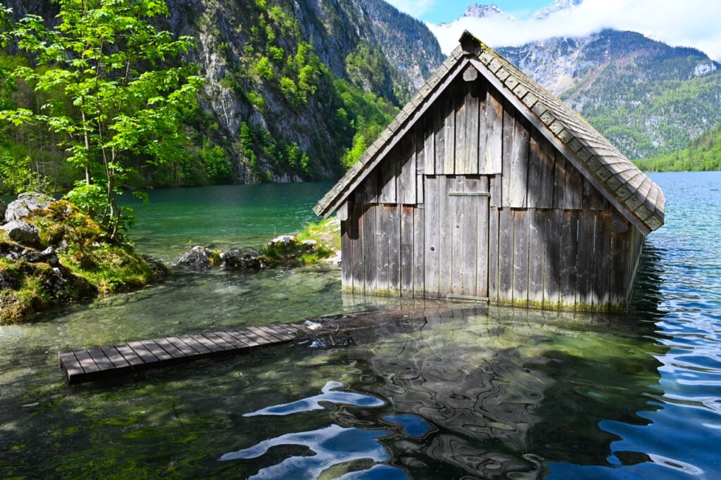
At the south shore of the Obersee lies the Fischunkelalm.
From May til Oktober two Sennerinnen (dairy maids) operate the Alm.
When I was there the Alm was not open..maybe lunch break.
The Fischunkelalm can be reached over a rather challenging foot path on the west side of the Obersee.

On sunny summer days with no wind, the entire lake is like a mirror – so I was told.
The foot path continues to Röthbachfall (waterfall).
The height varies depending on the sources between 350m and 470m.
Didn’t go, so no pics-sorry.